Chapter 2 - County Creation
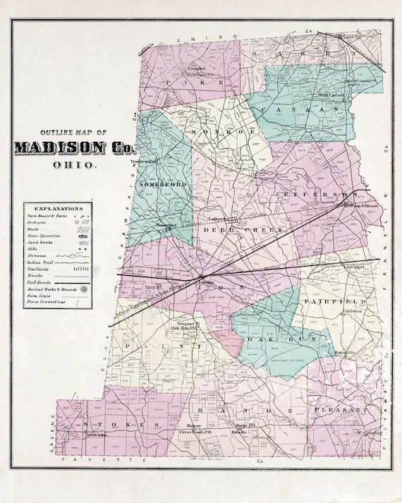
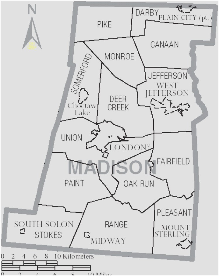
Madison County was formed form Franklin County on February 16, 1810. It was inhabited by a few settlers and Native Americans, but there were no villages. That meant that there was no place to dedicate as county seat. The Ohio General Assembly had the area surveyed and designated the location that is now London to be a seat of justice. By 1812, there were several families living there. The first court was held in a log cabin presided by Judge Thompson of Chillicothe. More information about London will be discussed later in other chapters.
The first settler in Madison County was Johnathan Alder who settled in 1804 about 5 miles north of Plain City in Franklin County. In 1806, he built a new cabin on Darby Creek, south of Plain City. So 1806 would be the year for Madison County’s first settler. His cabin is on display at the London Historical Society museum. As a child he was abducted in Virginia by Shawnee Indians, and then adopted by the Mingo Tribe and lived for many years with Native Americans. He eventually returned to the white community. His life is fascinating. See Johnathan Alder Wikipedia link. Settlers started coming to Madison County with most coming from neighboring Columbus in Franklin County. This group wanted to farm or just to escape the busy city.
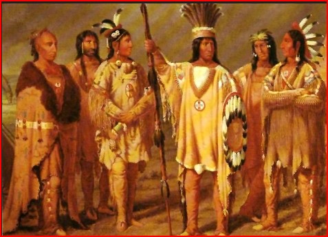
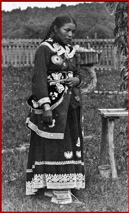
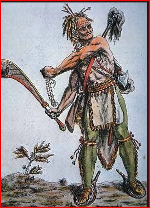
When white settlers began arriving, the Mingo and Wyandot Native Americans began to leave the area. In 1806, a solar eclipse occurred. History says that Native Americans shot arrows toward the sun to scare off evil spirits and that Tecumseh had accurately predicted its occurrence. Images below are Mingo and Wyandot Indians. Huron-Wendat Nation.


The first settlers came into what is now the Plain City area. It was then called Pleasant Valley, not a settlement, but the name of the area. In 1818, it was platted and named Westminister. It was later changed to Plain City, because Ohio already had a area named Pleasant Valley in Richland County, and a town called Pleasantville. I have researched and if there was a town called Pleasant Valley, I have never been able to locate it. Plain City grew because of the presence of the Atlantic and Great Western Railroad (A&GW)
As the county developed, families moved in and began farming. In those days, farms were small. A family could live on a few acres. They would fence the property, have a cow, a horse, a few pigs, maybe some sheep and chickens. They were self sufficient. These farms were close to each other, usually around a crossroads, or near a railroad. There were no paved roads or automobiles. A trip to London meant hitching up a horse to a wagon, taking a day to get there, spending the night and coming back the next day. Someone saw a need and started a small general store, maybe out of a house and eventually built a store. Perhaps a newly wed and ordained minister moved in and the group of farmer families helped build a church or perhaps a small multi-grade school. A death occurred and one of the farmers donated a a piece of land for a cemetery, or maybe it opened next to the church. If the community was next to a railroad, a grain elevator might be built. A town was born, and for years thrived and met the needs of the neighborhood. As you read the comments about each community in this section, you often see the remark never or unplatted. This means that there were never streets laid out. These small communities usually just grew along the intersecting roads. Sometimes along just one leg of the intersections. Some were T-intersections, not crossroads. Sometimes a single lane or road was graded next to a railroad and all the homes in community were on that one road.
Why didn’t they grow into town and cities? What happened? There are several reasons. Two reasons are very easy to understand. The first was the paving of roads. The second was the invention of the automobile. A trip from anywhere in the county could now be made in less than 30 minutes. The other two reasons are not as evident, but significant. The first was the invention of television, and the second air conditioning. These four factors destroyed the sense of community. Why shop at a local high-priced store when you can drive less than 30 minutes to a large well-stocked supermarket with lower prices? Eventually the community general store and mom and pop businesses failed and closed. As children were born, they grew up and moved away. The small farms could not support multi-families. America’s railroads were replaced by semi-trucks and many grain elevators closed. Television and air conditioning stopped people sitting out in the evening and visiting neighbors. There were still houses, some became rentals and people living there might not even know or even talk to their neighbors. The unincorporated village as a thriving community died, leaving just a clustered group of houses.
The next chapter identifies and provides information about all of the existing and former communities in the county.
As the county grew, each little community was linked to its neighbor communities and to London, the county seat by a series of roads. Many of these were Indian trails or dirt lanes. Eventually the state and the nation needed access and a network of Interstate and federal highways, state highways and country roads were built. The following sketch provides an overview of the major roads in Madison County. In 1870, the first paved road of asphalt was laid in New Jersey. Paving began to spread across the U.S. and paved roads began to appear in Madison County in the early 1900’s and continued for several decades. All named roads in the county are paved. In some communities there are still some unpaved streets and lanes. Detailed maps are available from the county engineers.
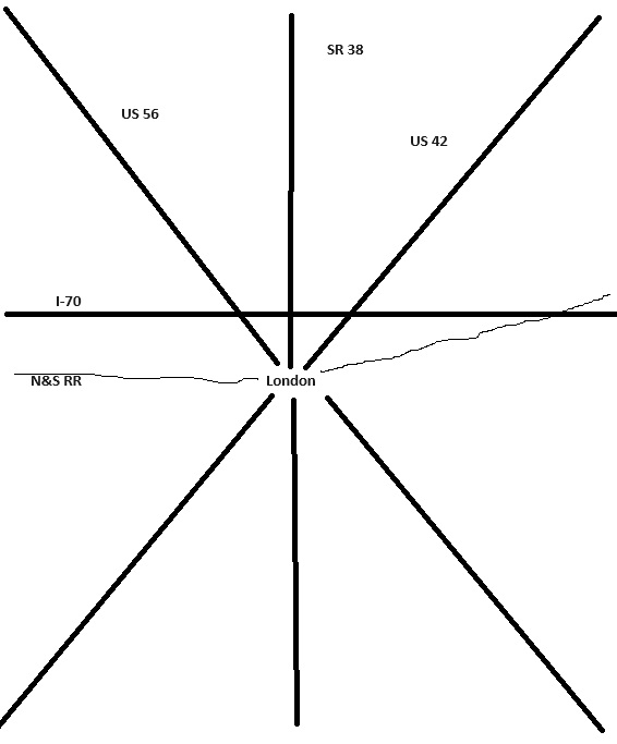
Besides the roads in the above sketch, there are others of importance.
SR 142 only exits in the county and is a spur of US 42 from downtown London, ending in Plain City.
SR 323 only exists in the county and runs east/west between SR 31 in South Solon to SR 45 just north of Mt Sterling.
US 40 parallels I-70 about 4 miles to the south. and has connections to I-70 at US 42 and SR’s 56, 29 and 142.
I-71 passes through the south-eastern corner of the country and has one Madison County exit at SR 45. However there is an exit for SR 38 just south of the county line in Fayette County.
Originally, Madison County was almost completely an agricultural county. It is still largely agricultural. But one area has evolved differently. Because the area between West Jefferson and London lies along the Norfolk and Southern Railroad, close to I-70, a large percentage of this area contains miles of warehouses for many corporations including a very large Amazon facility. Along this route there are also hi-tech companies, automobile parts manufacturers and a number of companies that support agriculture. Since the State Capital, Columbus is only 12 miles from the Madison County line, a number of housing developments in the county are bedroom communities for people working in Columbus. This has an impact on the school districts in the country, as this influx of families continues.